Padilla, Murkowski Introduce Bill for Atmospheric River Forecasting
Overview of Atmospheric Rivers
Atmospheric rivers are long, narrow corridors of concentrated moisture in the atmosphere, often stretching thousands of kilometers and carrying vast amounts of water vapor. These rivers, which can be hundreds of miles wide, are responsible for delivering significant precipitation to coastal regions, particularly in North America, Europe, and East Asia. They transport water vapor from tropical regions to higher latitudes, where it falls as rain or snow. Atmospheric rivers are typically several thousand kilometers long and only a few hundred kilometers wide, and a single one can carry a greater flux of water than Earth’s largest river, the Amazon River. There are typically 3–5 of these narrow plumes present within a hemisphere at any given time. These have been increasing in intensity slightly over the past century.
The moisture content, temperature, and wind patterns associated with atmospheric rivers are unique. The moisture content is typically high, with atmospheric rivers carrying water vapor equivalent to multiple Mississippi Rivers. The temperature is usually cool, and the wind patterns are complex, often involving strong winds that can enhance the precipitation process. These rivers are often associated with extratropical cyclones and frontal zones, which can further intensify the precipitation events.
Atmospheric rivers have a significant impact on the West Coast, particularly in regions like California, Oregon, and Washington. Historical examples of severe flooding events caused by atmospheric rivers include the storms of October 2023, which brought heavy rain and snowfall to the region, leading to widespread flooding and significant economic damage. These events have caused more than 80 percent of flood damage across the West, with annual damages exceeding $1 billion. Climate change is exacerbating these impacts, with atmospheric rivers expected to become more frequent and intense, leading to increased flood risks and economic losses. By 2090, atmospheric rivers are projected to cost $2.3 to $3.2 billion in annual damages and increase in width by nearly 25 percent. Over 50 atmospheric rivers made landfall across the West Coast from October 1, 2023, to September 30, 2024. These events highlight the urgent need for improved forecasting and preparedness measures to mitigate the impacts of atmospheric rivers.
The current challenges in predicting and forecasting atmospheric rivers are significant. Traditional weather models often struggle to accurately capture the complex dynamics of these events, leading to uncertainties in timing and location. Data gaps and technological limitations further complicate the forecasting process, making it difficult to provide timely and reliable warnings to affected communities. The legislation introduced by Senators Padilla and Murkowski aims to address these challenges by establishing a forecast improvement program within the National Oceanic and Atmospheric Administration (NOAA). This program will focus on developing accurate, effective, and actionable storm forecasts and warnings, evaluating innovative observation tools, and improving atmospheric river hazard communication. By enhancing the understanding and prediction of atmospheric rivers, this legislation seeks to reduce flood risks, bolster emergency preparedness, and improve water management strategies along the West Coast.
Importance of Improved Forecasting
The historical context of atmospheric river forecasting reveals a journey marked by evolving prediction methods and persistent limitations. The concept of atmospheric rivers, which transport vast amounts of water vapor, was first recognized in the late 1990s through weather model-based forecasts globally by Zhu and Newell. This led to the identification of atmospheric rivers (ARs) as narrow plumes of intense, vertically integrated water vapor transport, meandering through the atmosphere. The term “atmospheric river” was coined in the early 2000s, building upon earlier studies that described “tropospheric rivers” [Source: AMS].
Early warning systems have played a crucial role in mitigating the impacts of atmospheric rivers. For instance, the USGS has developed a rating scale to categorize atmospheric rivers by their transport of water vapor, using intervals to classify their strength. This scale has been adapted from a 2019 article and is used to provide early warnings for potential heavy rain and snow events. The National Oceanic and Atmospheric Administration (NOAA) has also made significant improvements in understanding atmospheric rivers and their importance to both weather and climate. NOAA’s National Weather Service forecasters issue warnings for potential heavy rain and snow events, which are crucial for communities to prepare for the extreme weather associated with atmospheric rivers [Source: AMS].
However, the effectiveness of early warning systems has been limited by significant errors in forecasts from operational centers. For example, atmospheric rivers that affect California have limited observations over the ocean, which complicates accurate forecasting. Additionally, the connection between atmospheric rivers and large-scale atmospheric variability over the North Pacific has been a challenge for researchers, with most efforts focused on sub-seasonal prediction (5 weeks or less) of ARs and limited efforts made for AR forecasts on multi-seasonal timescales [Source: AMS].
Current challenges in forecasting atmospheric rivers include technological limitations, data gaps, and the complexities of atmospheric science. Forecasting agencies face key challenges such as making the most of available data, making accurate predictions using models, and turning predictions into actionable information. Significant errors remain in forecasts from operational centers, and the connection between atmospheric rivers and large-scale atmospheric variability over the North Pacific is a challenge for researchers. Most research has focused on the sub-seasonal prediction (5 weeks or less) of ARs and only limited efforts have been made for AR forecasts on multi-seasonal timescales [Source: AMS].
Real-world examples of forecasting failures and their consequences highlight the need for improved forecasting methods. For instance, the series of atmospheric rivers in early 2023 demonstrated how quickly California can move from one extreme to another, as severe drought conditions gave way to flooding and one of the largest snowpacks in 70 years. This underscores the importance of improved forecasting for water management and flood control in the western United States [Source: AMS].
The role of climate change in exacerbating the challenges of atmospheric river forecasting is a critical aspect that cannot be overlooked. Climate models and basic physics suggest that atmospheric rivers will become moister and more intense in the future, as a warmer atmosphere can hold more water vapor. This trend is expected to continue, with atmospheric rivers becoming longer and wider, leading to increased frequency and intensity of extreme weather events. The impacts of climate change on atmospheric rivers are expected to be significant, with flood damages triggered by atmospheric river storms projected to triple from $1 billion a year to over $3 billion a year by the end of the century unless action is taken to reduce global greenhouse gas emissions [Source: AMS].
In conclusion, the historical context of atmospheric river forecasting highlights the evolution of prediction methods and the limitations encountered over the years. Early warning systems have been instrumental in mitigating the impacts of atmospheric rivers, but significant challenges remain in terms of technological limitations, data gaps, and the complexities of atmospheric science. The role of climate change in exacerbating these challenges underscores the need for adaptive and resilient forecasting systems to prepare for future increases in atmospheric river frequency and intensity.
Introduction of the Improving Atmospheric River Forecasts Act
The Improving Atmospheric River Forecasts Act, introduced by U.S. Senators Alex Padilla (D-Calif.) and Lisa Murkowski (R-Alaska), marks a significant bipartisan effort to enhance the accuracy and reliability of atmospheric river forecasts. This legislation aims to reduce flood risks and bolster emergency preparedness, addressing a critical weather phenomenon that significantly impacts the western United States.
Padilla, a Democrat, and Murkowski, a Republican, bring together their respective political backgrounds and expertise to tackle this shared environmental challenge. Padilla’s focus on climate change and environmental justice aligns with Murkowski’s commitment to Alaska’s unique environmental issues, creating a powerful coalition for this legislation. The bipartisan support underscores the urgency and importance of improving atmospheric river forecasts, which are responsible for 30-50% of annual precipitation along the western U.S. and cause the majority of the flooding, with more than $1 billion in annual average flood damage in the western 11 states [Source: Marine Technology News].
The Improving Atmospheric River Forecasts Act is designed to achieve several key objectives. Primarily, it seeks to improve forecast accuracy by establishing a forecast improvement program within the National Oceanic and Atmospheric Administration (NOAA). This program will focus on developing accurate forecasts, evaluating innovative observation tools, and enhancing data collection and modeling techniques. The legislation also aims to reduce flood risks by providing more precise predictions of atmospheric river events, allowing for better preparedness and response measures. Additionally, the act supports emergency preparedness by ensuring that communities are better equipped to handle the impacts of these storms, which can include severe flooding, landslides, and power outages [Source: Padilla].
The bipartisan nature of the bill is a testament to the cooperation between Democrats and Republicans in addressing a shared environmental concern. This collaboration is crucial given the complex and multifaceted nature of atmospheric river forecasting. The legislation reflects a recognition that improving forecasts requires a unified effort, leveraging the strengths of both political parties to develop effective solutions. The Improving Atmospheric River Forecasts Act is a significant step forward in enhancing our ability to predict and mitigate the impacts of atmospheric rivers, ultimately saving lives and protecting communities.
The key provisions of the bill include the establishment of a forecast improvement program within NOAA. This program will be responsible for developing accurate forecasts, evaluating innovative observation tools, and enhancing data collection and modeling techniques. The legislation also directs NOAA to establish a standalone atmospheric river forecast improvement program that would develop and implement new observation and forecasting tools. This program will work closely with the National Weather Service to improve the lead time, accuracy, and dissemination of forecasts of atmospheric rivers throughout the United States [Source: Padilla].
In summary, the Improving Atmospheric River Forecasts Act represents a critical step in enhancing our ability to predict and mitigate the impacts of atmospheric rivers. Through bipartisan cooperation, the legislation aims to improve forecast accuracy, reduce flood risks, and enhance emergency preparedness. By establishing a forecast improvement program within NOAA, the act ensures that communities across the western United States are better equipped to handle the challenges posed by these powerful storms. The success of this legislation will depend on continued collaboration and innovation, as we work to develop more effective forecasting tools and response measures.
Key Provisions of the Bill
NOAA’s role in atmospheric river forecasting is pivotal in enhancing the accuracy and reliability of weather predictions, particularly in regions prone to heavy rainfall and flooding. The National Oceanic and Atmospheric Administration (NOAA) is tasked with developing and refining forecasting models to better understand and predict atmospheric river events. These rivers, characterized by their narrow and elongated paths of moisture transport, are responsible for significant precipitation events, particularly in coastal and mountainous regions.
NOAA’s responsibilities in this domain include the development of accurate forecasts, the evaluation of innovative observation tools, and the authorization of necessary equipment to improve forecasting capabilities. This involves leveraging advanced technologies such as satellite imagery and numerical weather models to track the movement and intensity of atmospheric rivers. For instance, NOAA’s GOES West weather satellite captures detailed images and information that are crucial for refining forecast models, thereby enhancing predictions of atmospheric river intensity and duration [Source: SciJinks].
The collaboration with public and private partners is another key aspect of NOAA’s strategy. Water districts, flood management agencies, and research institutions play a vital role in the development and implementation of the forecast improvement program. This cross-sector collaboration is essential for enhancing forecasting capabilities and public safety. For example, NOAA works closely with the River Forecast Centers (RFCs) to monitor river systems and provide real-time hydrologic forecasts and guidance. These centers are responsible for delivering critical information to water resources cooperators and Weather Forecast Offices, ensuring that communities are better prepared for potential flood events [Source: NOAA].
The evaluation process for innovative observation tools is another critical component of NOAA’s approach. NOAA selects and implements new technologies based on specific criteria, such as their ability to enhance forecast accuracy and reliability. The expected outcomes of these evaluations include improved forecasting models and better public safety measures. For instance, NOAA’s Atmospheric River Portal provides access to information, images, analyses, diagnostics of current conditions, forecasts, and projects related to atmospheric rivers. This portal includes experimental tools using the NCEP Global Forecast System, which helps in refining forecast models and improving predictions [Source: NOAA].
In summary, NOAA’s role in atmospheric river forecasting is multifaceted, involving the development of accurate forecasts, collaboration with various stakeholders, and the evaluation of innovative observation tools. These efforts collectively aim to enhance forecasting capabilities and improve public safety, particularly in regions affected by atmospheric river events.
Reducing Flood Risks
The Improving Atmospheric River Forecasts Act aims to significantly enhance the accuracy of atmospheric river forecasts, a critical step in reducing flood risks and improving emergency preparedness. This legislation mandates the National Oceanic and Atmospheric Administration (NOAA) to establish a forecast improvement program within the National Weather Service. The program will leverage advanced modeling, satellite imagery, and real-time data analysis to achieve higher prediction accuracy, particularly in the lead-up to atmospheric river storms.
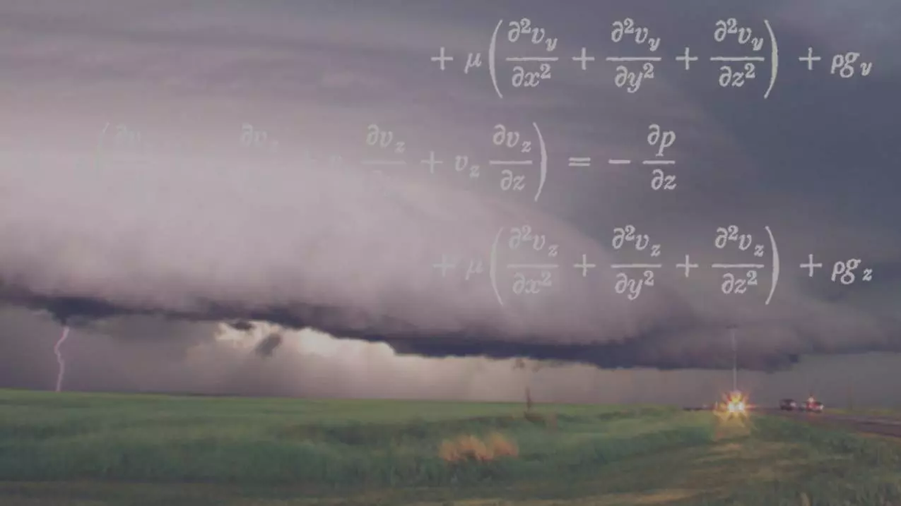
Advanced modeling techniques, such as machine learning algorithms, are at the forefront of this initiative. These algorithms can process vast amounts of data to identify patterns and predict atmospheric conditions with unprecedented accuracy. For instance, deep learning models like LSTM networks have been shown to improve forecast accuracy by analyzing historical data and identifying complex relationships that traditional models might miss [Source: Yavas, 2024]. Additionally, ensemble methods combine the predictions of multiple models to enhance overall accuracy, providing a more robust and reliable forecast [Source: ResearchGate, 2024].
Satellite imagery plays a crucial role in this effort by providing real-time data on atmospheric conditions. High-resolution satellite imagery can capture detailed information about cloud formations, temperature gradients, and moisture levels, which are essential for predicting the formation and movement of atmospheric rivers. This data is integrated into predictive models to refine forecasts and improve their accuracy [Source: Shmueli, 2023].
Real-time data analysis is another key component of the forecast improvement program. By continuously monitoring and updating data, the program can quickly adapt to changing atmospheric conditions and provide timely warnings. This capability is particularly important for atmospheric rivers, which can develop rapidly and bring significant rainfall and flooding to affected regions [Source: Owusu-Adjei, 2023].
The enhanced forecast accuracy enabled by the Improving Atmospheric River Forecasts Act will lead to improved emergency preparedness. Early warning systems will be developed to alert communities in the path of atmospheric rivers, giving them valuable time to take protective measures. Evacuation plans and response strategies will be tailored to the unique characteristics of these storms, ensuring that emergency responders are better equipped to handle the challenges they pose [Source: Datamation, 2024].
Community engagement and public awareness are also crucial aspects of enhanced preparedness. Educating the public about atmospheric rivers and the importance of heeding early warnings can help reduce the impact of these storms. Local communities can develop their own preparedness plans, such as creating flood barriers, stockpiling emergency supplies, and establishing evacuation routes. This collaborative approach ensures that everyone is prepared to respond effectively to the threats posed by atmospheric rivers [Source: Chen, 2023].
In the long term, reducing flood risks through improved atmospheric river forecasting will yield significant benefits. Cost savings in flood mitigation efforts will be realized as communities become more resilient to the impacts of these storms. Critical infrastructure, such as roads, bridges, and buildings, will be better protected, reducing the need for costly repairs and reconstruction. Additionally, the preservation of lives and property will be enhanced, as early warnings and preparedness measures minimize the human and economic toll of atmospheric river events [Source: Sankhye, 2020].
The Improving Atmospheric River Forecasts Act represents a significant step forward in enhancing our ability to predict and respond to atmospheric river storms. By leveraging advanced technologies and fostering community engagement, this legislation aims to reduce flood risks and improve emergency preparedness, ensuring a safer and more resilient future for all.
Conclusion
The Improving Atmospheric River Forecasts Act represents a significant step forward in enhancing public safety and water management strategies along the West Coast. By improving forecasting accuracy and reducing flood risks, the bill addresses a critical need exacerbated by climate change. The bipartisan support and collaboration with various organizations underscore the importance of this legislation in creating a more resilient future for communities affected by atmospheric river storms.
Sources
- AMS – Atmospheric River Research
- Marine Technology News – Padilla, Murkowski Introduce Atmospheric River Forecasting Bill
- Padilla – Padilla, Murkowski Introduce Bipartisan Bill to Create Atmospheric River Forecasting Program
- SciJinks – Scientists monitor atmospheric rivers to plan for emergencies and water supply issues
- NOAA – River Forecast Centers (RFC) monitor the Nation’s river systems
- NOAA – Atmospheric River Portal
- Nature – Yavas, 2024
- ResearchGate – Ensemble Methods, 2024
- ScienceDirect – Shmueli, 2023
- medRxiv – Owusu-Adjei, 2023
- Datamation – Predictive Analytics Techniques, 2024
- ScienceDirect – Chen, 2023
- MDPI – Sankhye, 2020
Leave a Reply